Land and Maps: interactive section

A condensed source of information for curious and enthusiasts.
If there is a section of our website we are proud of, it is "Land and Maps." Months of work, hours and hours on the computer with programmers trying to fulfill all our requests. And there were quite a few, we assure you.
THE INTERACTIVE MAP
Our desire was to create an interactive map capable of bringing you "here with us": our vineyards are located in various areas of the Euganean Hills and it is not easy to summarize in a few words the pedoclimatic richness that surrounds us. So, mapping vineyard by vineyard, each with its characteristics and the grape varieties it hosts, we tried to immerse you in our world.
Entering "Land and Maps" from the navigation menu, you can immediately stop at the map or continue to navigate the Estates.
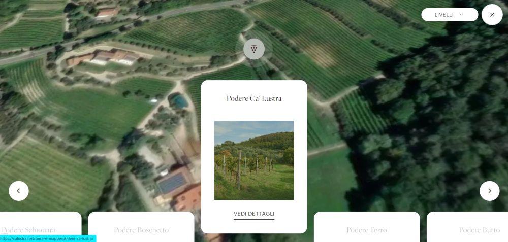
ESTATES AND VINEYARDS
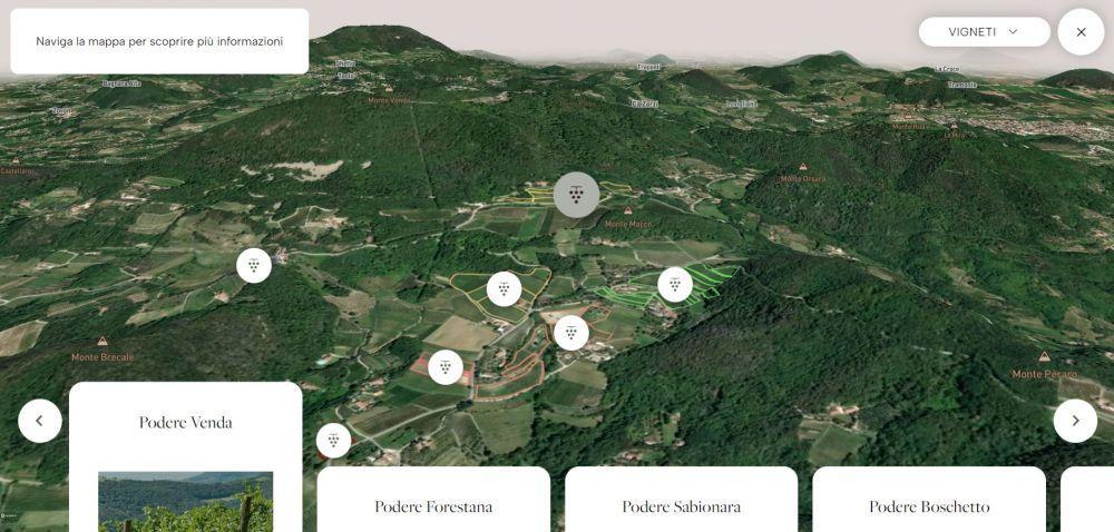
By clicking on "explore our vineyards," you will be enchanted: by moving 360° as in a video game, you can zoom in on valleys and hills, orienting yourself with the names of the villages and reliefs. You will realize the conformation of the Euganean Hills with inhabited, cultivated and wooded surfaces. Moving on the map, we invite you to click on the bunches of grapes: they contain the card of each Estate with technical and descriptive information. In this context, we chose to call an ensemble of "Vineyards" in a specific area an "Estate." With "Vineyards" we identify the individual grape varieties cultivated in different plots.
Something curious for enthusiasts: in each Estate, you will find real-time weather and historical data on rainfall, temperature, and humidity. Do you know the typical characteristics of a wine produced in a hot and dry year? What do heatwaves during the summer entail? Or, what happens if there are significant temperature variations between night and day?
If you come to visit us in our cellar, we will be glad to answer these and other questions, to tell you about the climatic trend of recent years and the solutions we have adopted. A good opportunity to discover the evolution of wines starting from climatically different vintages is the "Old Vintages" Tasting, in which we compare different vintages of the same wine.
MAPS AND LAYERS
If all this is not enough for you and you still have a bit of curiosity, on the map we recommend opening the menu that suggests the "layers": basic map, vineyards, lithographic. Three different solutions to navigate the same map, favouring respectively an in-depth study of the territory, our Vineyards (marked on the map) and the composition of the soils of all the Euganean Hills. From each level, you can directly access Estates and Vineyards. Just zoom in, you will find everything.
Want to know more? Register as a WineLover, you will have access to more information about our wines and vineyards. The goal over time is to create a collection as comprehensive as possible.
All of this has a great charm for us and we hope it does for you, too. This map aims to be a useful tool for everyone: experts can dive into the data for analysis and comparisons; enthusiasts can quench their thirst for information; the curious can discover how much richness is hidden in the Euganean Hills. And everyone, we hope, will desire to get to know our territory a little better.